


Parcel Data
Know your territory with parcel property data
Transform parcel data into strategic advantage
Cotality Parcel Data provides detailed U.S. real estate and property information, featuring 250+ attributes, including land parcel boundary data, land parcel numbers, ownership, land use, and tax assessments.
We source extensive data from raw public records and use advanced proprietary technology to transform data points into comprehensive property intelligence to help propel your decisions.
Accurate geospatial insights and risk assessment
Cotality’s Parcel Data empowers you with precise property boundaries, accurate land valuations, updated ownership details, and crucial zoning information. It provides essential environmental and financial insights for informed decisions and risk assessment, enabling versatile land use and comprehensive property analysis.

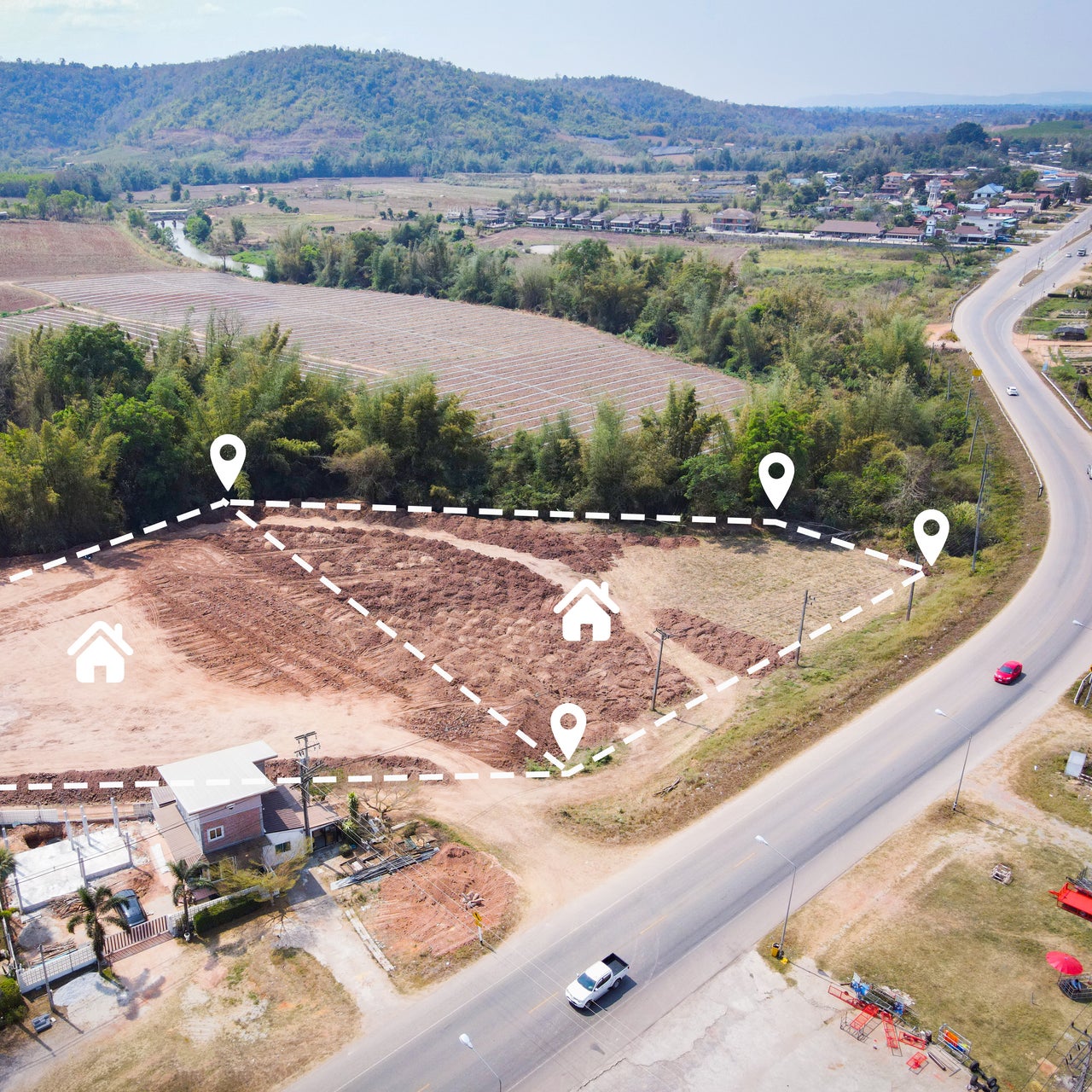
Parcel boundaries and ownership
Defines the geographical limits of a property and provides up-to-date ownership records, ensuring accuracy for legal, development, and regulatory purposes.
Valuation and market insights
Offers current and historical land valuations based on factors like location, zoning, and market trends, helping professionals assess property worth and investment potential.
Zoning and land use regulations
Details permissible land uses, including residential, commercial, and industrial zoning, ensuring compliance with local regulations and guiding development strategies.
Financial and environmental data
Provides insights into property taxes, liens, and environmental risks, helping assess financial obligations and potential hazards that impact property value and development.
FAQ
How does Parcel Data help real estate development?
What information does Parcel Data provide for land valuations?
Why is property ownership information important?
How does our Parcel Data help with zoning information?
How can we help you?
Let's get this conversation started! Our team is here to provide you with more information and answer any questions you may have.
Trying to reach us by phone?
Get in touch with our sales team at (866) 774-3282. We're here Monday to Friday from 7 a.m. to 5 p.m. CT.
Looking for support?
Visit our dedicated support page to find support for all our products.
